BlockInfo
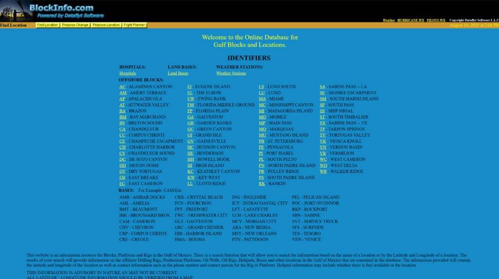
BlockInfo is a free, community-updated resource for locating platforms, rigs, and infrastructure across the Gulf of America. It provides search tools and contact data to help users identify offshore facilities by name or coordinates.

BlockInfo
BlockInfo is a free, community-updated resource for locating platforms, rigs, and infrastructure across the Gulf of America. It provides search tools and contact data to help users identify offshore facilities by name or coordinates.

Search by Name or Coordinates
Quickly locate offshore rigs, platforms, wells, and helipads using flexible search options. Enter a site name, latitude, or longitude to pull up relevant results from across the Gulf of America.
Access Location and Contact Details
Each entry includes advisory data such as coordinates, facility type, phone numbers, and contact personnel. This helps improve coordination with offshore sites and support teams.
Built for Pilots, Dispatchers, and Operators
From helipad fuel status to base locations, BlockInfo supports a wide range of roles. It simplifies field logistics by making critical offshore information easy to find in one central place.
Community-Powered Data Resource
BlockInfo relies on community input to maintain its growing database of offshore infrastructure. Users can contribute updates and corrections to ensure the platform remains as accurate as possible. While the data is advisory in nature and should be verified, it offers a valuable snapshot of activity zones, facility types, and general accessibility throughout the Gulf of America.
Search and Filter Offshore Locations
The built-in search tool allows users to find offshore locations using either a facility name or precise geographic coordinates. Once found, each listing provides identifying details such as platform type, function, and available services. This supports better pre-flight planning, scheduling, and emergency preparedness.
Advisory Contact and Facility Data
Many listings include contact information for on-site personnel, phone numbers, and notes on helipad fuel availability. This supports quick outreach and operational coordination. All information is advisory and may not reflect the most current conditions, so users are encouraged to verify location data from a map or official source before acting.
Community-Powered Data Resource
BlockInfo relies on community input to maintain its growing database of offshore infrastructure.
Users can contribute updates and corrections to ensure the platform remains as accurate as possible. While the data is advisory in nature and should be verified, it offers a valuable snapshot of activity zones, facility types, and general accessibility throughout the Gulf of America.
Search and Filter Offshore Locations
The built-in search tool allows users to find offshore locations using either a facility name or precise geographic coordinates. Once found, each listing provides identifying details such as platform type, function, and available services. This supports better pre-flight planning, scheduling, and emergency preparedness.
Advisory Contact and Facility Data
Many listings include contact information for on-site personnel, phone numbers, and notes on helipad fuel availability. This supports quick outreach and operational coordination. All information is advisory and may not reflect the most current conditions, so users are encouraged to verify location data from a map or official source before acting.
Know Where You’re Headed
BlockInfo helps your team plan offshore operations with more clarity and fewer unknowns. By centralizing community-provided location data, it supports field awareness, communication, and mission readiness across the Gulf of America.